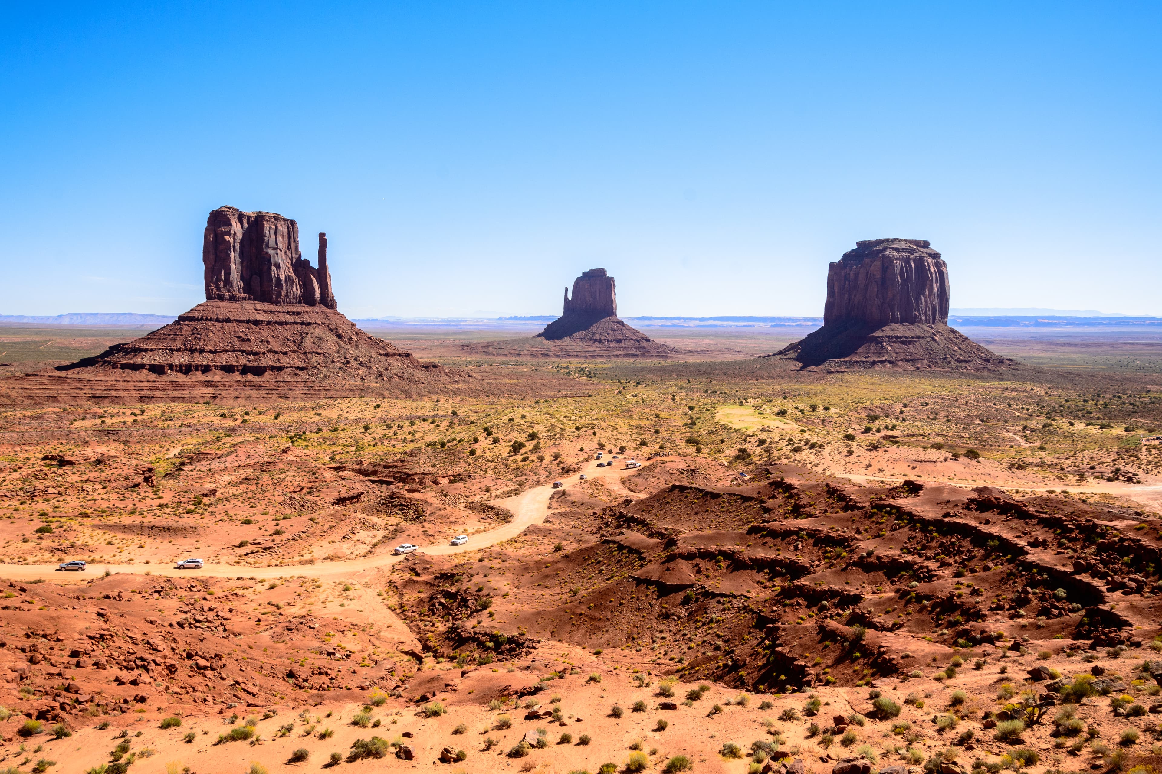
American Southwest
United States

Denver
United States
American Southwest
Denver
💰 Budget
🛡️ Safety
American Southwest
The Southwest's gateway towns (Sedona, Flagstaff, Page, Williams) have low crime rates. The real risks are environmental: extreme heat, flash floods, altitude sickness on the rim, dehydration, and long distances between services. More national-park visitors die from heat and falls here than anywhere else in the system.
Denver
Denver is generally safe for visitors in core neighborhoods (LoDo, RiNo, Capitol Hill, Cherry Creek, Wash Park), but property crime and visible homelessness have both risen sharply since 2020. Car break-ins are extremely common — never leave anything visible. The 16th Street Mall and stretches of Colfax Avenue have a rougher feel at night. The bigger danger for most travelers is environmental: altitude, sun, and weather catch visitors off guard.
⭐ Ratings
🌤️ Weather
American Southwest
The American Southwest spans a huge elevation range — from desert floors at 900 meters to canyon rims above 2,500 meters — so weather varies dramatically. Low deserts (Phoenix, Page) bake in summer (40°C+), while Grand Canyon South Rim and Flagstaff can get snow in winter. Sedona sits in between. The July-September "monsoon" brings sudden, violent thunderstorms and flash floods.
Denver
Denver has a semi-arid, high-altitude climate with 300+ days of sunshine a year and very low humidity. The altitude and dry air make the sun intense — UV levels are routinely "very high" even in winter. Weather is famously volatile: 70°F one afternoon and snowing the next morning is standard. Afternoon thunderstorms roll off the Front Range most summer days; big snowstorms punctuate winter. Hydrate aggressively regardless of the season — the combination of altitude and dry air dehydrates visitors fast.
🚇 Getting Around
American Southwest
A rental car is essentially mandatory to explore the Southwest. Distances are huge (Grand Canyon to Monument Valley is 280 km; Sedona to Page is 210 km) and public transport between parks is minimal. Once inside Grand Canyon South Rim, however, free shuttle buses efficiently cover all viewpoints. Amtrak's Southwest Chief stops at Flagstaff, and small regional airports serve the area.
Walkability: Downtown Sedona, Flagstaff, Williams, and Page are pleasantly walkable once you've parked. The Grand Canyon Village is very walkable — you can walk the entire South Rim Trail (21 km) past all major viewpoints. Outside town centers, distances and lack of sidewalks make walking impractical.
Denver
Denver is a sprawling car-oriented metro with a workable (by US standards) light rail and commuter rail network operated by RTD. The A Line train from Union Station to the airport is one of the best airport transit links in any US city. Core neighborhoods (LoDo, RiNo, Capitol Hill, Wash Park) are walkable individually, but connecting them typically means rideshare or transit. Rideshare is cheap and ubiquitous.
Walkability: Denver is walkable within neighborhoods but sprawling overall. LoDo, RiNo, Capitol Hill, Cherry Creek, and Wash Park each work on foot. Connecting them means rideshare, transit, or cycling. The altitude makes the first 24-48 hours of walking unexpectedly tiring — go slower than you think you should. Summer sun at 5,280 ft is aggressive even in cooler temperatures.
The Verdict
Choose American Southwest if...
you want Grand Canyon vistas, Sedona red rocks, Antelope Canyon light shafts, and the great American road trip through red-rock country
Choose Denver if...
you want a mile-high Rockies gateway — breweries, legal cannabis, Red Rocks, and ski towns an hour west
American Southwest