
Seattle
United States
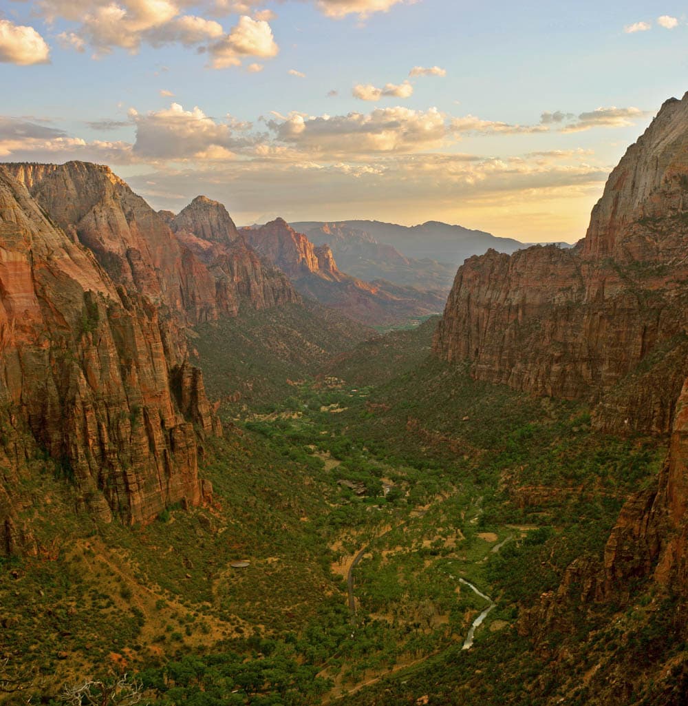
Zion National Park
United States
Seattle
Zion National Park
💰 Budget
🛡️ Safety
Seattle
Seattle is generally safe for visitors, with low rates of violent crime in tourist areas. Property crime (car break-ins, package theft, bike theft) is common. Homelessness is visible in parts of downtown, Pioneer Square, and SoDo. Avoid empty downtown streets and Third Avenue late at night.
Zion National Park
Crime at Zion is a non-issue — the real hazards are natural and they kill people every year. Flash floods, falls from Angels Landing, heat illness, hypothermia in the Narrows, and dehydration are the big five. The single most important pre-hike habit: check the NPS flash flood forecast at the visitor center or nps.gov/zion before ANY slot canyon or Narrows trip. "Probable" or "Expected" risk means do not enter — a storm 10 miles upstream can kill you even in bright sunshine at the trailhead.
⭐ Ratings
🌤️ Weather
Seattle
Seattle has a temperate oceanic climate — mild year-round with a pronounced wet season from October through April. Summers are dry, sunny, and cool. The famous rain is usually a fine drizzle ("Seattle mist") rather than downpours. Snow at sea level is rare.
Zion National Park
Zion's desert climate is defined by vertical relief — the canyon floor sits at 4,000 feet while the rims reach 6,500+ feet, meaning conditions can differ by 5-10°C between stops on the same hike. Summer is brutally hot on exposed trails (35-40°C) with dangerous afternoon monsoon thunderstorms and flash flood potential in slot canyons. Winter brings ice on Angels Landing and snow on the rims, with the canyon floor hovering between 0-15°C. Spring and fall are the ideal windows. The Virgin River stays a bracing 10-15°C year-round — plan Narrows gear accordingly.
🚇 Getting Around
Seattle
Seattle transit is run by Sound Transit (regional) and King County Metro (buses, streetcar, water taxi). Light rail, buses, streetcars, and Washington State Ferries form a useful network. An ORCA card works across all systems. Driving downtown is painful — traffic is consistently ranked among America's worst.
Walkability: Downtown, Pike Place Market, Pioneer Square, and Seattle Center are all walkable — but prepare for steep hills. Capitol Hill, Ballard, and Fremont are each walkable neighborhoods, but you'll want transit between them. The Link light rail plus walking will cover most of what you want to see.
Zion National Park
Zion's transportation story is simple: the free park shuttle is MANDATORY on the Zion Canyon Scenic Drive April through late November — no private vehicles past Canyon Junction. The shuttle runs a 9-stop loop roughly every 10-15 minutes, takes about 45 minutes end-to-end, and stops at every major trailhead and viewpoint. Springdale (the gateway town) has its own free town shuttle connecting lodges, restaurants, and the park entrance. A private car is only useful on the main drive December through early March, for reaching Kolob Canyons (30 miles northwest, separate entrance), or for the Zion-Mt. Carmel Highway. There is no rideshare service inside the park.
Walkability: Springdale itself is extremely walkable — a linear town strung along Highway 9 with restaurants, outfitters, and lodges all within a mile of each other. Inside the park the shuttle handles the vertical distances; hiking trails are a mix of paved strolls (Riverside Walk, Pa'rus) and serious climbs (Angels Landing, Observation Point). Kolob Canyons has its own scenic drive and short trailheads but is not pedestrian-connected to the main canyon.
The Verdict
Choose Seattle if...
you want Pike Place Market, coffee culture, Puget Sound ferries, and Mt. Rainier & Olympic National Park at the doorstep
Choose Zion National Park if...
you want red-rock slot canyons, Angels Landing's permit-lottery ridge, and the Narrows waded up the Virgin River
Seattle
Zion National Park