Charleston
United States

Seattle
United States
Charleston
Seattle
💰 Budget
🛡️ Safety
Charleston
The historic peninsula and the surrounding beach/barrier islands are very safe for visitors, with low violent crime and a heavy tourist-police presence downtown. Property crime (car break-ins, package theft) is the most common issue. Some outlying neighborhoods on the West Side and in North Charleston have higher crime rates but are not places most tourists end up.
Seattle
Seattle is generally safe for visitors, with low rates of violent crime in tourist areas. Property crime (car break-ins, package theft, bike theft) is common. Homelessness is visible in parts of downtown, Pioneer Square, and SoDo. Avoid empty downtown streets and Third Avenue late at night.
⭐ Ratings
🌤️ Weather
Charleston
Charleston has a humid subtropical climate — mild winters, long warm springs, and punishingly hot and humid summers. Hurricane season runs June through November with peak risk in August-September. Spring (March-May) and fall (October-November) are the sweet spots.
Seattle
Seattle has a temperate oceanic climate — mild year-round with a pronounced wet season from October through April. Summers are dry, sunny, and cool. The famous rain is usually a fine drizzle ("Seattle mist") rather than downpours. Snow at sea level is rare.
🚇 Getting Around
Charleston
The historic peninsula is small — about 2 miles north-to-south at its widest — and extremely walkable. Charleston has very limited public transit for a US city: CARTA buses exist but run infrequently and cover downtown poorly for tourists. Most visitors walk everything downtown and rent a car or use Uber/Lyft for beaches, plantations, and the airport.
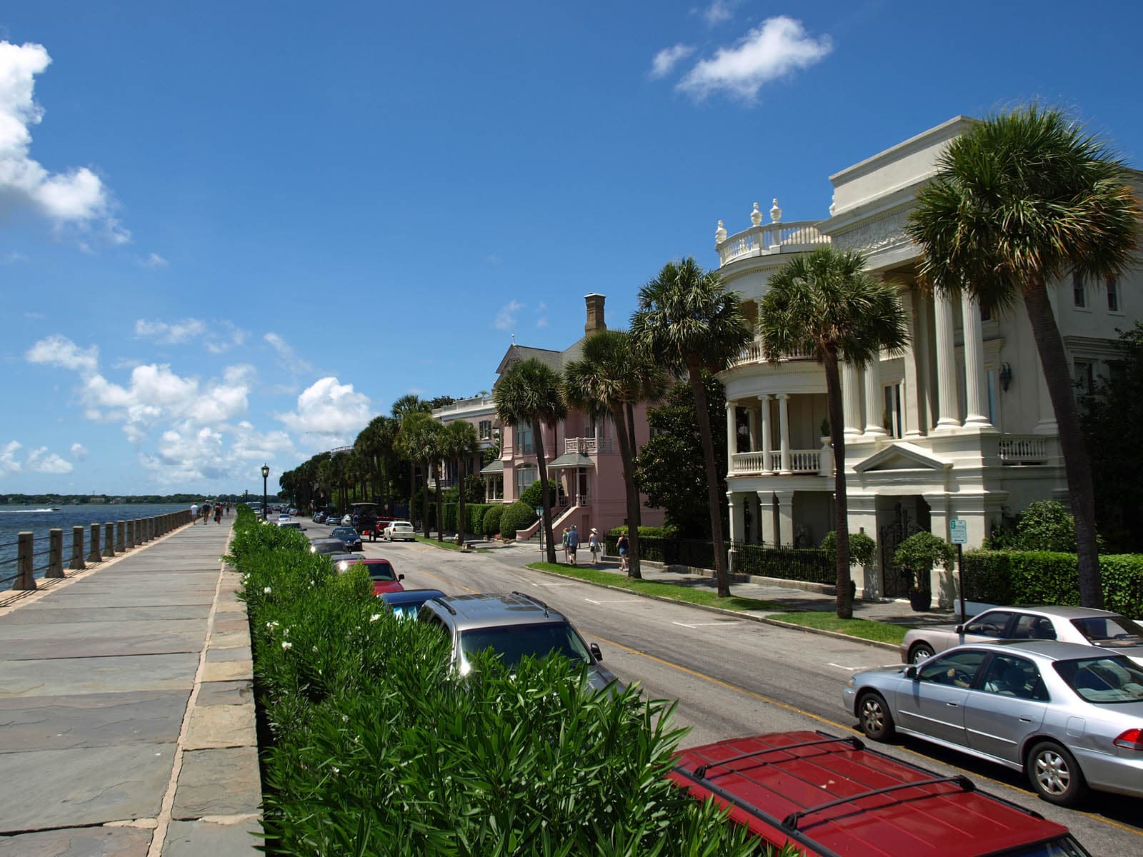
Walkability: Charleston's historic peninsula is one of the most walkable neighborhoods in the American South — flat, shaded by live oaks, well-maintained sidewalks (some brick and uneven), and tightly packed with destinations. Outside the peninsula, however, the metro is car-dependent and pedestrian infrastructure thins out fast.
Seattle
Seattle transit is run by Sound Transit (regional) and King County Metro (buses, streetcar, water taxi). Light rail, buses, streetcars, and Washington State Ferries form a useful network. An ORCA card works across all systems. Driving downtown is painful — traffic is consistently ranked among America's worst.
Walkability: Downtown, Pike Place Market, Pioneer Square, and Seattle Center are all walkable — but prepare for steep hills. Capitol Hill, Ballard, and Fremont are each walkable neighborhoods, but you'll want transit between them. The Link light rail plus walking will cover most of what you want to see.
The Verdict
Choose Charleston if...
you want pastel antebellum architecture, harbor-side history, modern Southern cuisine's spiritual home, and Gullah-Geechee heritage
Choose Seattle if...
you want Pike Place Market, coffee culture, Puget Sound ferries, and Mt. Rainier & Olympic National Park at the doorstep
Charleston
Seattle