Charleston
United States

Washington, D.C.
United States
Charleston
Washington, D.C.
💰 Budget
🛡️ Safety
Charleston
The historic peninsula and the surrounding beach/barrier islands are very safe for visitors, with low violent crime and a heavy tourist-police presence downtown. Property crime (car break-ins, package theft) is the most common issue. Some outlying neighborhoods on the West Side and in North Charleston have higher crime rates but are not places most tourists end up.
Washington, D.C.
Tourist areas of DC — the National Mall, Capitol Hill, Downtown, Georgetown, Dupont Circle, and Foggy Bottom — are generally safe during the day and well into the evening. Like any major US city, DC has neighborhoods with higher crime, mostly in parts of Southeast and Northeast that tourists rarely visit. Petty theft, car break-ins, and occasional phone snatching are the main concerns.
⭐ Ratings
🌤️ Weather
Charleston
Charleston has a humid subtropical climate — mild winters, long warm springs, and punishingly hot and humid summers. Hurricane season runs June through November with peak risk in August-September. Spring (March-May) and fall (October-November) are the sweet spots.
Washington, D.C.
Washington, DC has a humid subtropical climate with four distinct seasons. Summers are famously hot and sticky (the city was built on reclaimed swampland), while winters are cold but rarely extreme. Spring and fall are glorious and are the best times to visit.
🚇 Getting Around
Charleston
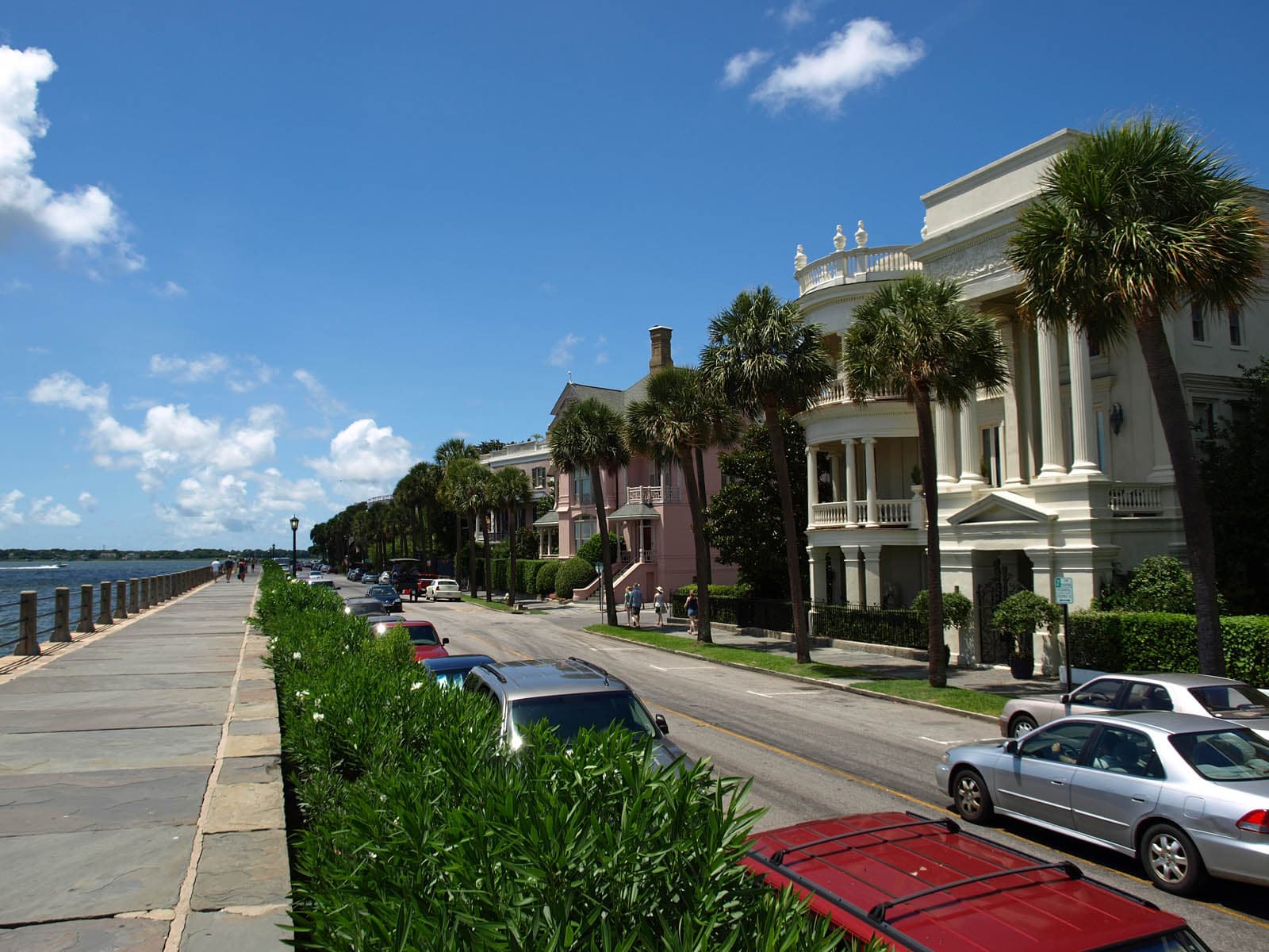
The historic peninsula is small — about 2 miles north-to-south at its widest — and extremely walkable. Charleston has very limited public transit for a US city: CARTA buses exist but run infrequently and cover downtown poorly for tourists. Most visitors walk everything downtown and rent a car or use Uber/Lyft for beaches, plantations, and the airport.
Walkability: Charleston's historic peninsula is one of the most walkable neighborhoods in the American South — flat, shaded by live oaks, well-maintained sidewalks (some brick and uneven), and tightly packed with destinations. Outside the peninsula, however, the metro is car-dependent and pedestrian infrastructure thins out fast.
Washington, D.C.
DC has an excellent public transit system run by WMATA (Washington Metropolitan Area Transit Authority). The Metro (subway) and Metrobus cover the city and much of the Maryland and Virginia suburbs. A SmarTrip card (or contactless phone tap) works across all Metro, bus, and Capital Bikeshare. Driving downtown is frustrating and parking is very expensive — transit or walking is the way to go.
Walkability: Central DC is one of the most walkable cities in the US, with wide sidewalks, a clear street grid, and short blocks. The National Mall itself is longer than it looks on maps (roughly 3 km end to end), so plan accordingly. Georgetown and Capitol Hill are especially pleasant on foot, though some DC hills can be steep.
The Verdict
Choose Charleston if...
you want pastel antebellum architecture, harbor-side history, modern Southern cuisine's spiritual home, and Gullah-Geechee heritage
Choose Washington, D.C. if...
you want world-class museums (all free), iconic monuments, Metro convenience, and four seasons of American political history
Charleston
Washington, D.C.